Click map below or go to Map Index
 
NCFishandGame.com hunting maps.
Visit our prime affiliates Expedia.com and Orvis, high quality fly fishing
Subscribe or UnSubscribe to our Newsletter or visit NCFishandGame.com storefront

Fishing Maps showing the Outer Banks of North Carolina
--- [Home] [Back]
Some of the nation's best angling waters, the Outer Banks is a sportfisherman's paradise.
 

Some of the nation's best angling waters, the Outer Banks is a sportfisherman's paradise. Fishing along the Outer Banks is offered in a variety of forms - surf and pier fishing, freshwater and sound fishing, inshore and offshore charter fishing - with the season lasting throughout the year.
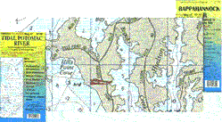
Fishing Hot Spot - Detailed Fishing Maps Fishing Hot Spots® sets the standard for others to follow. Each map is thoroughly researched, the information verified and cartography done digitally, with the most current and accurate GIS tools, to ensure an easy-to-read, accurate and affordable map. It's the map successful anglers have asked for by name for more than two decades. Our maps come in a variety of sizes and formats. Each body of water is carefully scrutinized and input is gathered from local experts and consumers as to what needs to be part of the product.

Fishing Hot Spots
Kitty Hawk-Wanchese to Grandy
SKU:
Saltwater Chart
The waters of the Croatan, Roanoke, Currituck and Albemarle sounds meet north of Roanoke Island here and offer excellent fishing in the brackish waters. Striped bass top the list of available species. Flounder, red drum, weakfish and spotted seatrout are also found in these waters.
Featured Species: Crappie, Flounder, Largemouth Bass, Red Drum, Spotted Seatrout, Striped Bass and Weakfish
See also
$16.95

Fishing Hot Spots
Oregon Inlet-Salvo to Kill Devil Hills
The many marinas and launch ramps in Manteo, Wanchese and Oregon Inlet make this area an ideal destination for fishermen and boaters. Oregon Inlet and Manns Harbor are famous for wintertime runs of large striped bass. Many other species inhabit the region seasonally. Featured Species: Bluefish, Cobia, Flounder, False Albacore, King Mackerel, Red Drum, Spanish Mackerel, Spotted Seatrout, Striped Bass and Weakfish
See also
$16.95

Fishing Hot Spots
Cape Hatteras-Ocracoke Inlet to Avon
Cape Hatteras is home to several prestigious fishing tournaments every year. Get ready for incredible offshore action. Inshore you will find red drum, bluefish, cobia, striped bass, Spanish mackerel and king mackerel. Recreation here is enjoyed year-round. Featured Species: Bluefish, Cobia, False Albacore, Flounder, King Mackerel, Red Drum, Spanish Mackerel, Spotted Seatrout, Striped Bass and Weakfish
See also
$16.95

GMCO Maps -- Great fishing maps
These are very detailed fishing maps. The pro series is waterproof, contain local names and waterways, fishing areas, piers, wrecks and artificial reefs, marinas and ramps, aids of navigation, and much more. Very good maps.


GMCO ProSeries Maps
Cape Lookout to New Topsail Inlet, NC
Covers from Core Banks to New Topsail Inlet includes; Navigational Aids, wrecks and artificial reefs, fishing piers, 1 minute Lat/Long grid system for GPS.
See also
$8.95

GMCO ProSeries Maps
Outer Banks from Kittyhawk to Ocrakoke, NC
Covers form Kitty Hawk to Ocracoke Inlet Includes; Navigational Aids, wrecks and artificial reefs, fishing piers, 1 minute Lat/Long grid system for GPS.
See also
$8.95

GMCO Laminated Maps
Outer Banks from Kittyhawk to Ocrakoke, NC
Covers form Kitty Hawk to Ocracoke Inlet Includes; Navigational Aids, wrecks and artificial reefs, fishing piers, 1 minute Lat/Long grid system for GPS.
See also
$18.95


DeLorme Atlas and Gazetteer
Atlas
You'll always have exactly the right kind of map with the uniquely versatile DeLorme Atlas and Gazetteer. These indispensable atlases cover individual states with unequaled detail, including back roads, land contours, lakes and streams, boat ramps, forests, wetlands, trailheads, campgrounds, public lands, hunting and fishing spots, and much more.
See also
$19.95
Please select the state above you are interested in

GMCO Chartbook
NC Tidal Waters Chartbook Waterproof
JUST UPDATED. North Carolina Chartbook WATERPROOF Most complete guide of all tidal waters in North Carolina. Includes: Navigational Aids, Marinas, Wrecks and Artificial Reefs, Facilities Listing and Much, Much, MORE!!
See also
$39.99
Enjoy this fabulous NC, outdoor resource.

[Suggestion Form] [Link to your site] [ ] [ ] [ ]
NCFishandGame.com has been an all volunteer site with profits going to charity in North American.
Copyright © 2005 NCFishandGame.com, see legal. All rights reserved. with suggestions or questions.